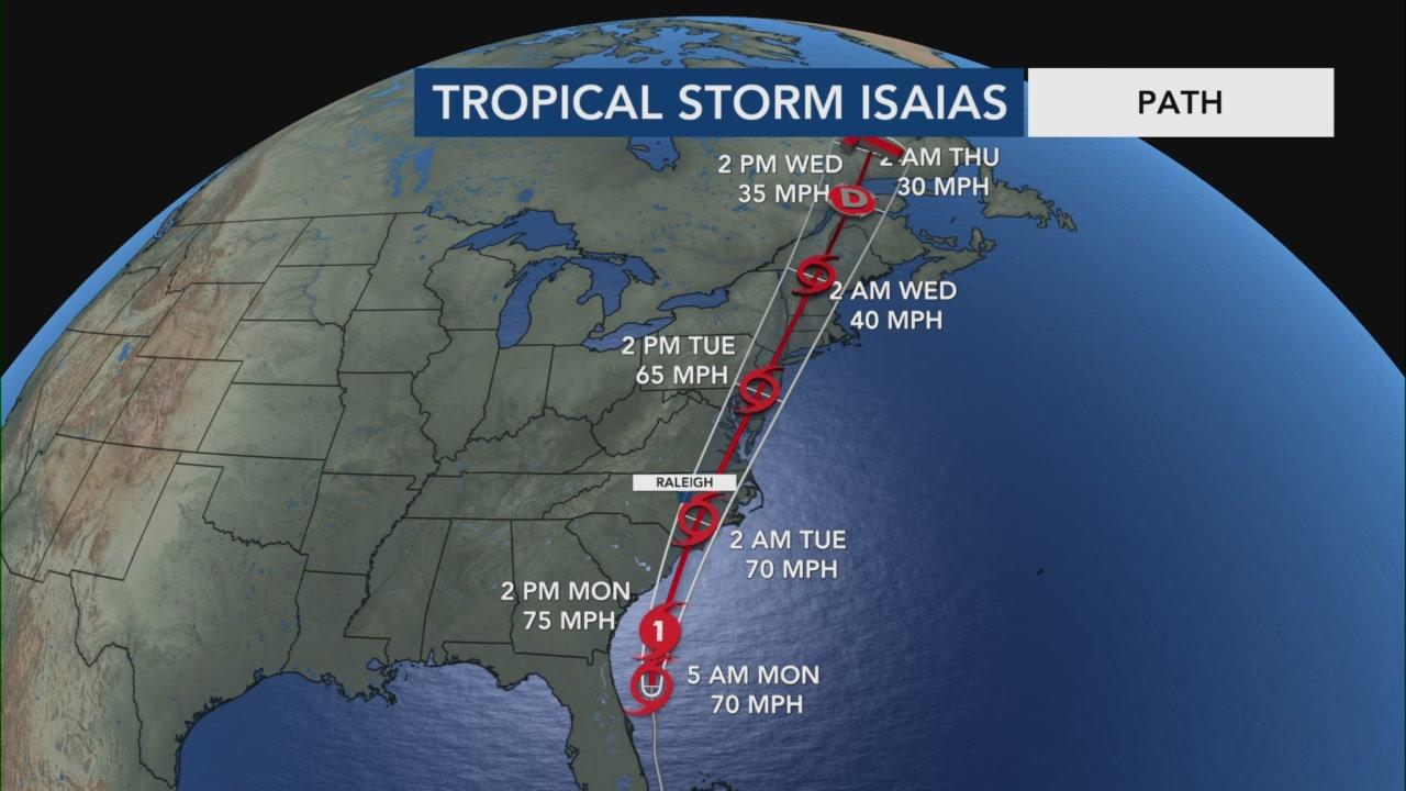
As Tropical Storm Isaias moves up the Florida and Georgia coasts, current tracking projections place the weather system over the Maryland region sometime midday or early afternoon tomorrow, Aug. 4, 2020. The storm is predicted to bring heavy rain and flooding, along with sustained winds in the 40-60 MPH range. Please note, however, that these projections are always subject to change as the storm takes its northerly course.
At this time, Haven Harbour Marina and Haven Harbour South are not planning to activate their emergency hurricane haul-out lists, however you may notify us to have your vessel hauled and dry-stored if you prefer.
We recommend that everyone, especially our slipholders, take the following necessary precautions now as a safeguard against the storm's potential threat to the area:
Take down and safely stow away any canvas, awnings and Bimini tops that are easily removable.
Remove all loose gear on the exterior and deck of the vessel and store below.
Take down head sails, or storm tie them, in addition to properly securing and storm-tying all furling sails.
Dinghies should be removed and properly stowed. If they cannot be easily removed, they should be securely tied and set to drain properly.
Install double lines on your boat and leave extra lines in a location onboard where they can be easily accessed by our storm watch crew if needed.
If you are a slipholder of Haven Harbour Marina or Haven Harbour South and find that you need assistance in storm-prepping your vessel, please contact us as soon as possible, preferably by phone at (410) 778-6697. The staff of Haven Harbour Marina Resorts will continue to monitor the storm and advise as to any changes in our storm preparations.
FEATURED PHOTO: Tropical Storm Isaias' potential path as of 9:00 a.m. Aug. 3, 2020. Photos courtesy of CNN and ABC.
As of late a seasonal locale, Rock Hall is giving nearby Chestertown a run for their money in terms of number of open, year-round dining establishments.